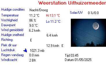
| Weerstation Uithuizermeeden | |||
|---|---|---|---|
| LAST READING AT TIME: 15:25 DATE: 01 May 2025, time of next update: 15:30 | |||
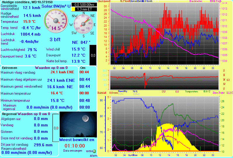
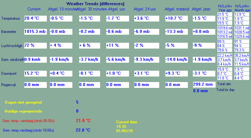
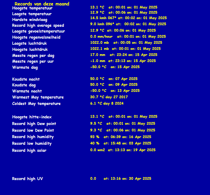
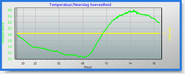
| Current Weather | Zonnig/Droog | Current Temperature | 24.8°C (76.6°F) (Heat Index 24.8°C ), Apparent temp 25.1°C , Apparent temp solar 32.4°C |
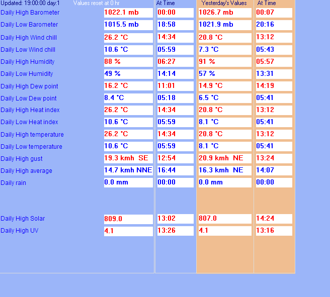
| Maximum Temperature (since midnight) | 26.2°C at: 14:34 | Minimum Temperature (since midnight) | 10.6°C at: 05:59 |
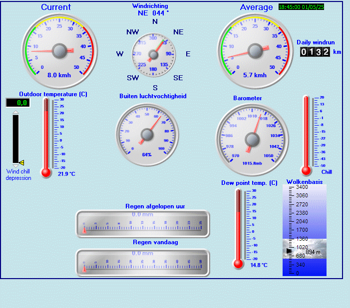
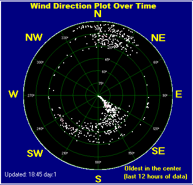
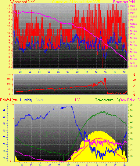
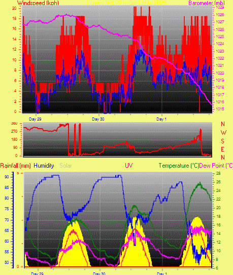
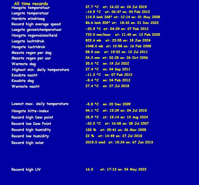
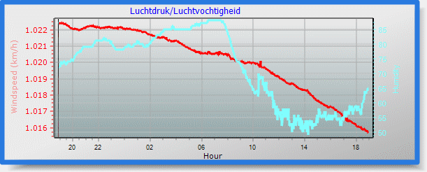
| Average windspeed (ten minute) | 8.1 kmh (4.4 kts) | Wind Direction (ten minute) | NNE (13°) |
| Windchill Temperature | 24.8°C | Maximum Gust (last hour) | 19.3 kmh (10.4 kts) at: 15:16 |
| Maximum Gust (since midnight) | 19.3 kmh (10.4 kts) at: 12:54 | Maximum 1 minute average (since midnight) | 14.3 kmh (7.7 kts) at: 13:48 |
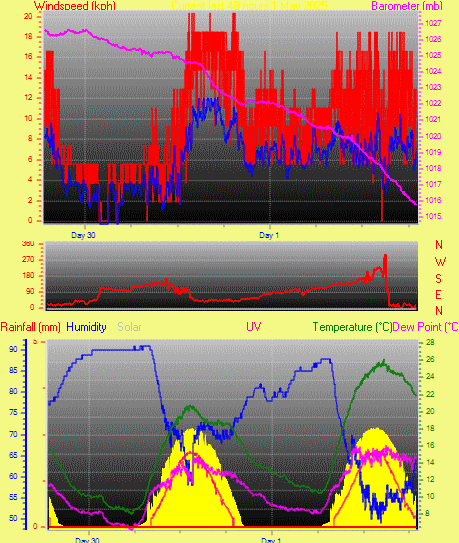
| Rainfall (last hour) | 0.0 mm | Rainfall (since midnight) | 0.0 mm (0.00 in.)--- |
| Rainfall This month | 0.0 mm (0.00 in.) | Rainfall To date this year | 137.0 mm (5.39 in.) |
| Maximum rain per minute (last hour) | 0.0 mm/min | Maximum rain per hour (last 6 hours) | 0.0 mm/hour |
| Yesterdays rainfall | 0.0 mm | DewPoint | 15.1°C (Wet Bulb :18.9°C ) |
| Humidity | 55 %, Humidex 28.8°C | Barometer corrected to msl | 1017.4 mb |
| Pressure change | -0.6 mb (last hour) | Trend (last hour) | STEADY |
| Pressure change (last 12 hours) | -3.9 mb | Pressure change (last 6 hours) | -2.5 mb |
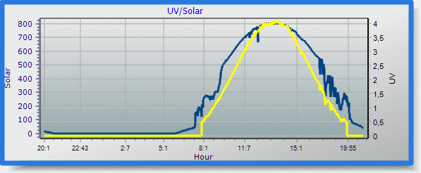
| Current solar | 707 W/m² | Current UV | 3.1 |
| Maximum solar (since midnight) | 809 W/m² | Maximum UV (since midnight) | 4.1 |
| Current 05:57 hours of sunshine today, current sky: Zonnig | |||
| Sunshine hours for the year: | 312:56 hrs | Sunshine hours for the month: | 05:57 hrs |
| Current evapotranspiration rate 6.1 mm per day. Yesterday's reading 4.3 | |||
Use the RELOAD facility on your browser to retrieve the latest data.